Keeping a dispersed field team in sync often turns into a complicated process. Yet the phone in everyone's pocket already knows where it is. The real question is how to get that information to the team when there is no coverage.
The problem with describing a location over the radio
In a team spread across the field, the most repeated sentence is "where are you". The answer usually comes as a description: upstream from the creek, behind the second ridge, left at the house with the red roof. The person giving the description knows the terrain. The person receiving it usually does not.
Reading out coordinates does not quite solve it either. Reading numbers over a radio is slow and error-prone, and the other end still has to transfer those numbers onto a map.
Meanwhile the phone in everyone's pocket already knows where it is. The problem is not finding the location. It is getting it to the team when there is no coverage.
The team on a map
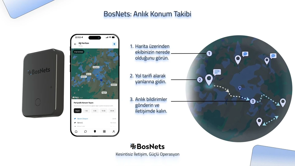
In BosApp you see everyone on the network on a single map. Who is where, when they last reported a position, and whether they are currently connected all sit on the same screen.
The map works offline. In an area with no coverage the base map stays loaded, so your team's positions land on real terrain rather than an empty screen.
You decide how often to share
Location sharing does not have to be permanently on. Periodic broadcasting comes with a few intervals: off, one minute, five minutes, ten minutes and thirty minutes.
That choice adjusts two things at once. Frequent broadcasting keeps the map livelier but uses more battery and more of the network's capacity. Infrequent broadcasting protects the battery, at the cost of slightly staler information on the map. Using a short interval during an active search and a long one while holding position is a common approach.
You can also send your location once, on demand, at any moment. Teams that would rather not leave continuous broadcasting on usually work this way.
Do not just see them, reach them
Selecting a teammate on the map gives you routing to where they are. For teams that do not know the terrain, this removes the "I know where they are but not how to get there" problem.
Seen from the centre
The manager in the coordination centre sees the same picture through BosLog, on a computer screen. Everyone's position in the field, incoming messages and marked points all gather on one screen. From there the centre can assign tasks and follow the entire operation from a single place.
What that means in the field is simple: nobody has to interrupt their work to give a status report.
Frequently asked questions
Does location sharing work where there is no coverage?
Yes. Location travels the same way messages do, over the network the devices build among themselves. No mobile network or internet is required. Because the map also works offline, you see positions on real terrain rather than a blank screen.
Does my location have to be shared continuously?
No. You can turn periodic broadcasting off entirely and send your location once, on demand, whenever you choose. If periodic broadcasting is on, you pick an interval of one, five, ten or thirty minutes.
Can everyone on the network see my location?
Your location goes to the members of your group. When teams are split into independent sub-groups, one group's positions do not reach another, while the coordination centre still sees the whole picture through BosLog.
How much does frequent location sharing affect battery life?
The shorter the interval, the more both the device and the phone consume. BosMag is designed to run for 48 hours on a charge; using a short interval during active searches and a long one while holding position is the most practical way to protect that.